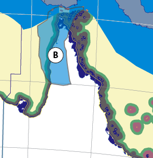
Thanks for checking this Region out.
This Region is prepared on the a-political concept that if you are interested in 'place' in Australia, the most important aspect that defines 'place', is the 'flow of water'. The Senate is interested in 'place'.
This Region defines its boundaries at the top of the ridge, where water flows one way rather than the other. This leads to a very interesting 'place'.
We are seeking a debate with people who live in this proposed new Region. We know we've got the Region pretty well correct; after all, it's just geography. But if you live in this Region you can tell us a lot of interesting things.
- Do these boundaries define a place that is unique; different to every other Region in Australia? We think that that is probably quite likely.
- Is it a great place, worthy of recognition?
- Upon formation, what should be the name of this Region? Who would be the Lord Mayor? Who would be the two Senators who represent this Region? Who would be the additional Senator that represents the interests of Aboriginal & Torres Strait Islander peoples in this region? What benefit would flow from a concept of super-Regions for the whole of the Gulf of Carpentaria and for the Cape York Peninsula?
- Would life be enhanced if it was on a fast Ring-Rail that links the Capital City to every other Capital City in Australia?
- Many other interesting things!
We think that this is a great new concept of regional statehood based on real concepts that define life in this particular Region. What do you think?
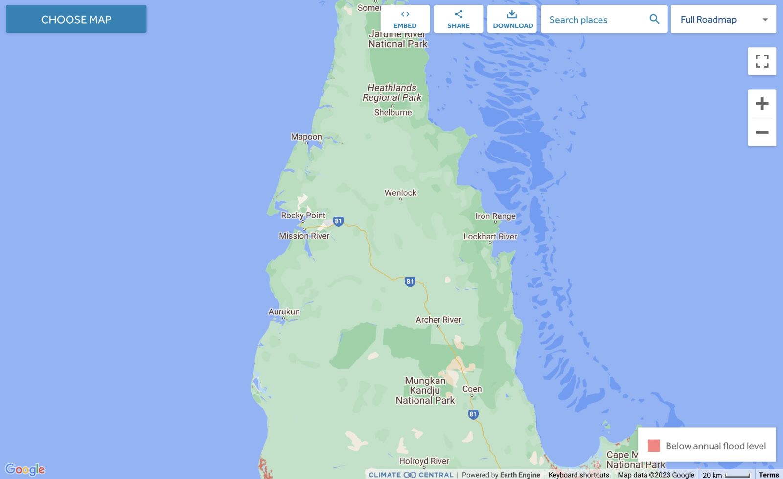
Land projected to be below annual flood level in 2050
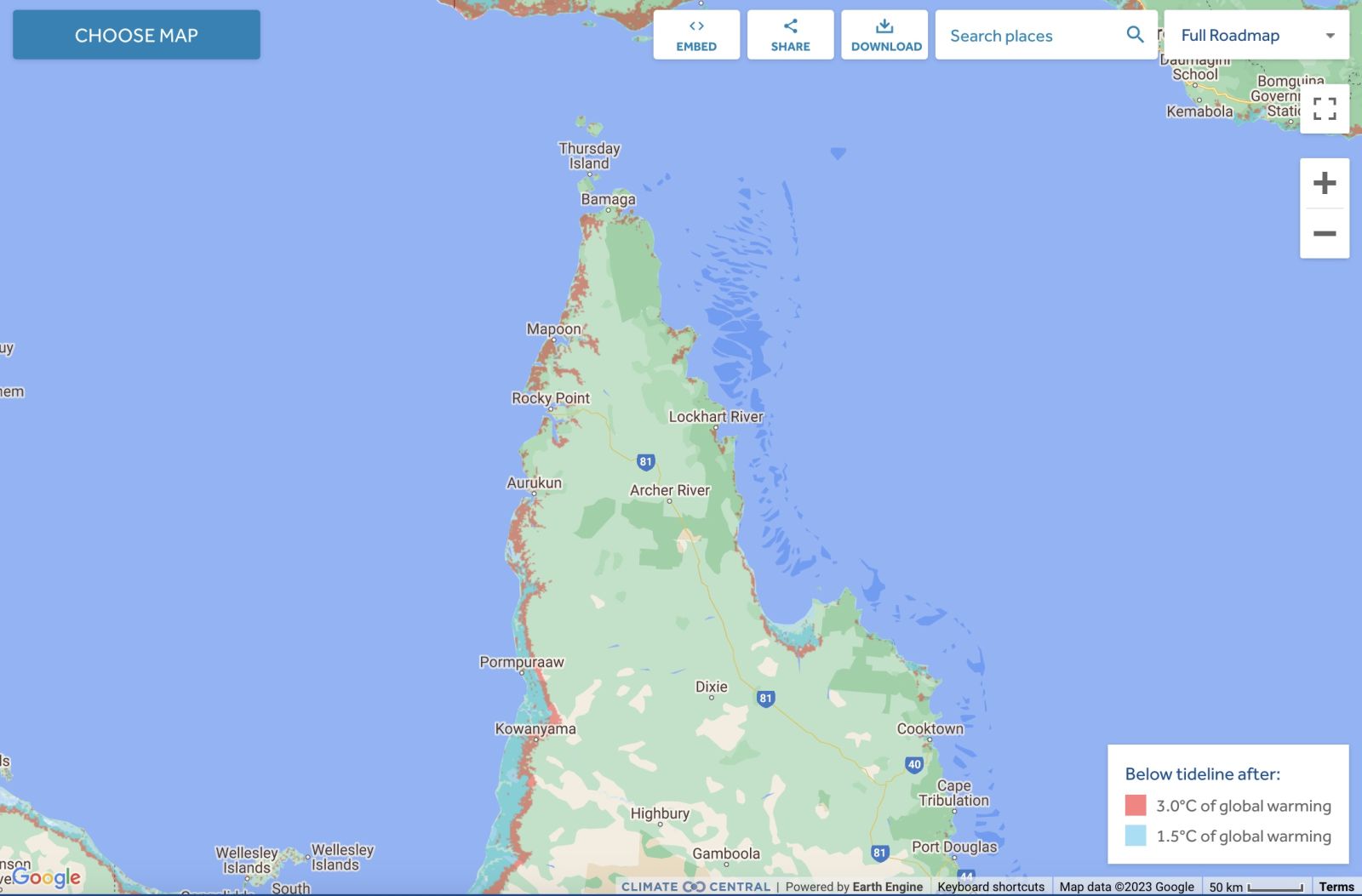
Comparison: long-term sea level outcomes
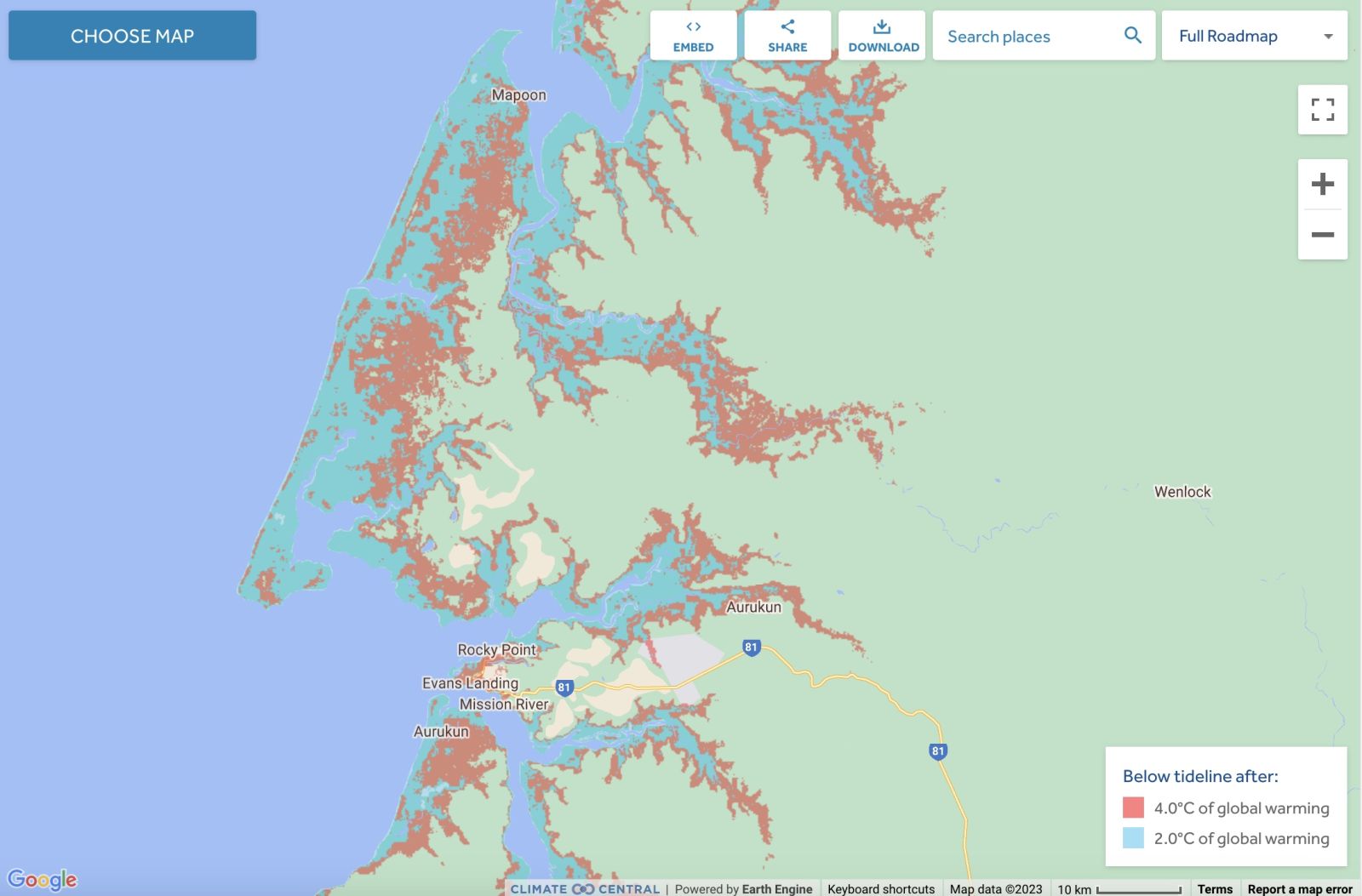
Comparison: long-term sea level outcomes
https://coastal.climatecentral.org/map/10/142.0805/-12.4056/?theme=warmi...
Torres Strait Islands - Land projected to be below annual flood level in 2050
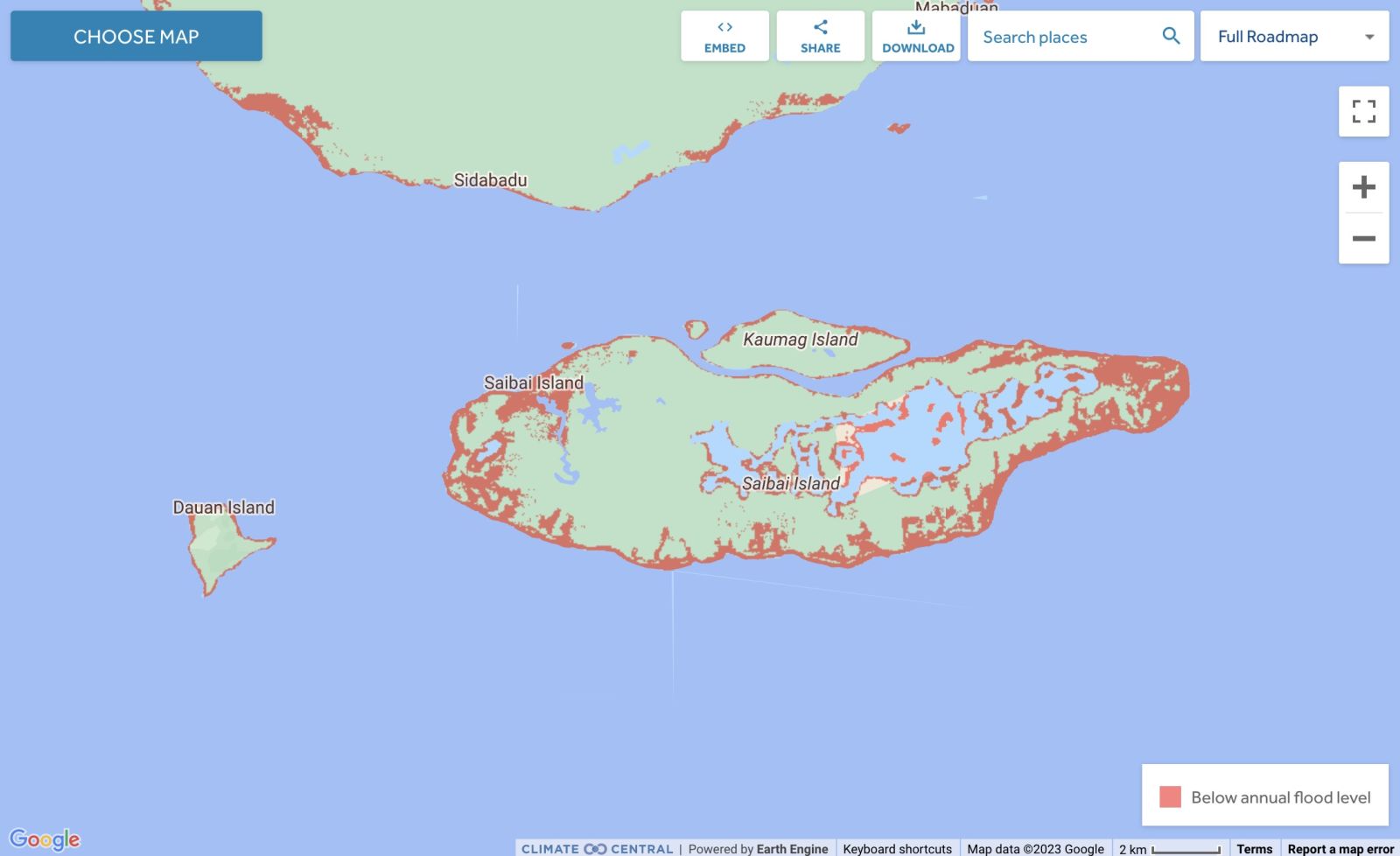
Torres Strait Islands - Comparison: long-term sea level outcomes
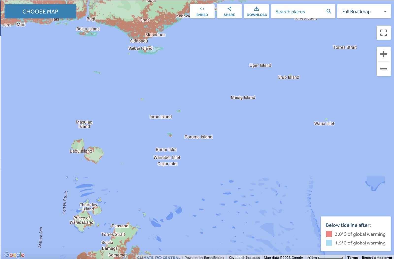
Torres Strait Islands - Comparison: long-term sea level outcomes
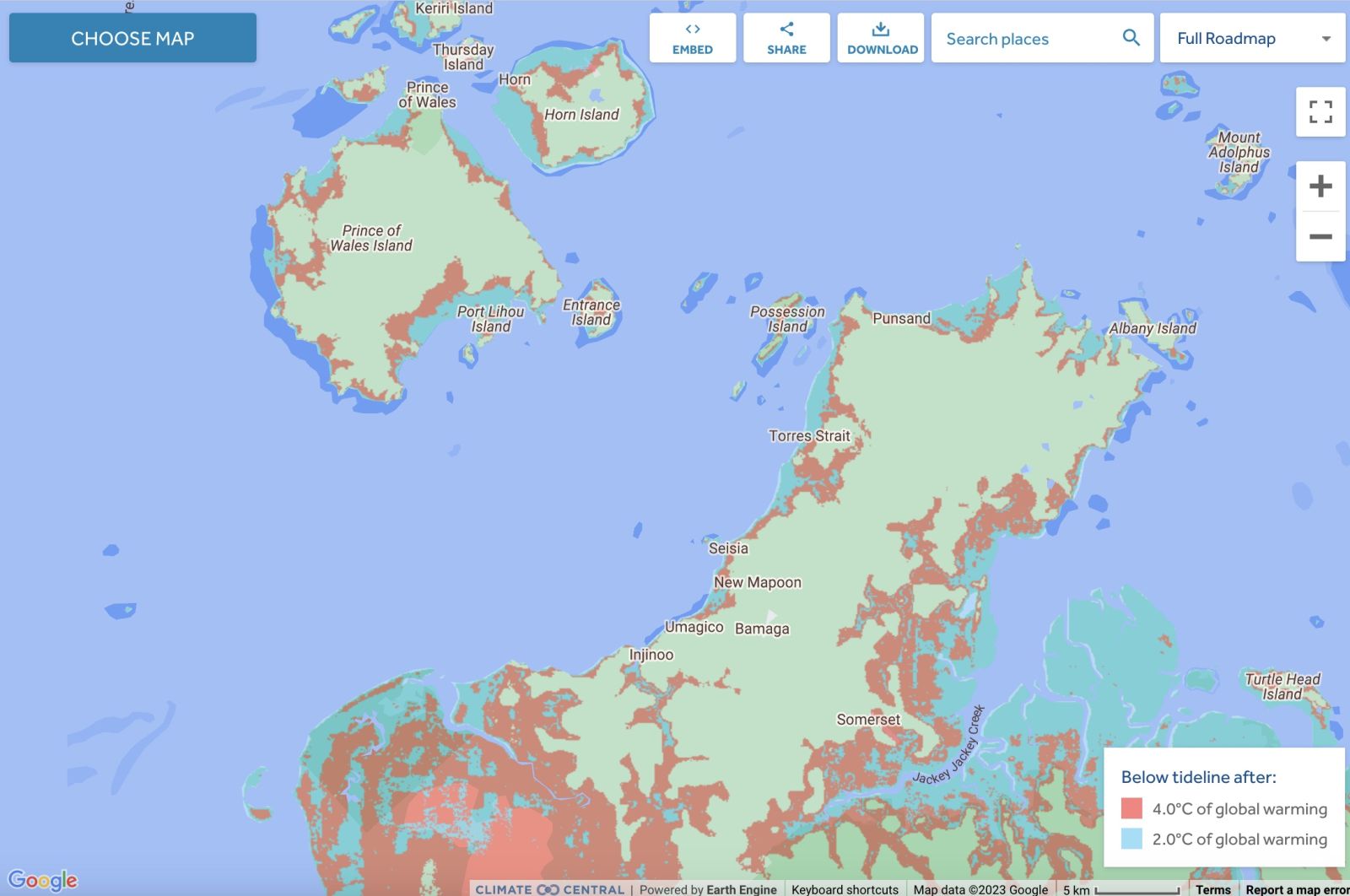
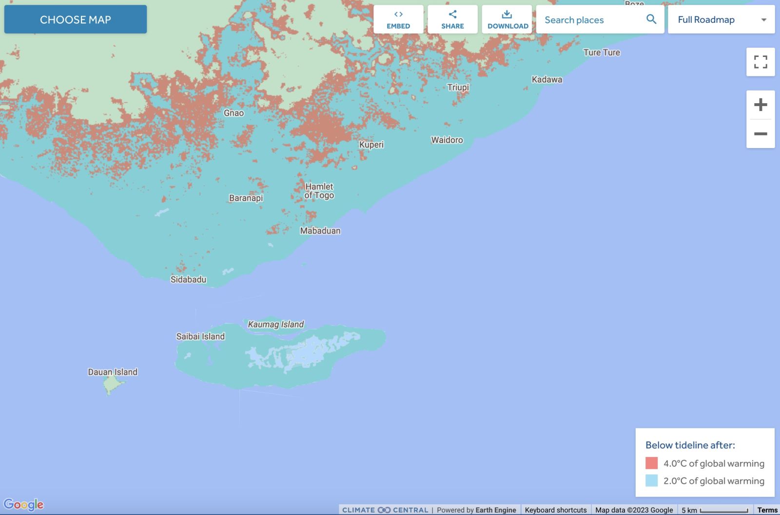
Some Torres Strait Islands are lost at +2.0°C - Comparison: long-term sea level outcomes
|
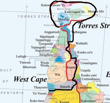
Aboriginal Australia:
|
|
|
NOTE1: Likely indicators only; for original Aboriginal Australia Map © 1991 & restrictions on its copy & use, see Aboriginal Australia Map NOTE2: The red line is part of the original Aboriginal Australia Map © 1991. The black line is added by Bloggerme for discussion only. It shows the likely State boundary based on the flow of water only. As "the ridge" (See FOWTOR) naturally impacts on the development of the language, social or nation groups of the Indigenous people of Australia, the proposed border is often identical to the group boundary shown on the Aboriginal Australia Map. This is as was expected. Variations are social/historical & result in a particular language, social or nation group being represented in two adjoining States. |
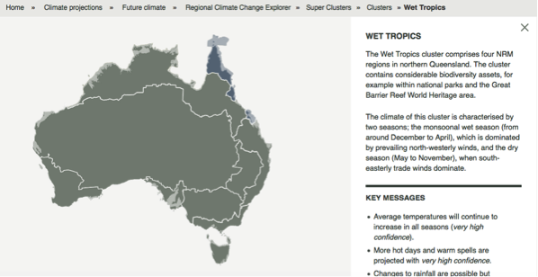 |
Other regional projections - CSIRO part of Wet Tropics regionThe CSIRO has regions for projecting the impact of Climate Change. See https://www.climatechangeinaustralia.gov.au/en/climate-projections/futur... This state, Carpentaria State (C), is one of the clear projections in a CSIRO cluster called "Monsoon North region". CSIRO's Wet Tropics region coincides exactly with BloggerMe's A,B,AG. |
Nuclear weapons
Centre ground zero CGZ - Weipa - 475 kilotons (431 kilotonnes)
https://nuclearsecrecy.com/nukemap/
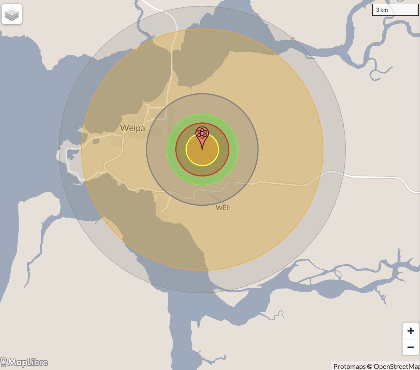
Location: https://australia.places-in-the-world.com/2144209-place-weipa.html LEGEND
Click here to:

Comments
Steve Irons
Tue, 06/10/2020 - 6:57pm
Permalink
Beauty
Murray Islands
https://www.pinterest.com/pin/418553359096034883/
Horn Island
https://www.pinterest.com/pin/418553359097224287/
Steve Irons
Sun, 09/03/2014 - 11:57pm
Permalink
Gillian
http://www.abc.net.au/news/2014-03-09/tropical-cyclone-gillian-bureau-of...
Steve Irons
Sat, 23/11/2013 - 7:36pm
Permalink
Cape York
Map http://www.cylc.org.au/files/6513/6125/1442/NTRB_Boundary_Map.jpg
Steve Irons
Sat, 23/11/2013 - 7:32pm
Permalink
CYLC
Cape York Land Council
http://www.cylc.org.au/
Conversation
Fri, 10/05/2013 - 8:33pm
Permalink
Dugongs are safer in Torres Strait
"The status of Australian dugongs varies greatly. Shark Bay supports a large dugong population with minimal human pressures, making it the most secure dugong population in the world. On the other hand, the urban coast of the Great Barrier Reef (GBR) region between Cairns and Bundaberg poses many threats to dugongs.
"Torres Strait is the world’s largest dugong habitat. Surveys conducted by my group at James Cook University show that the region contains a remarkable 58% of the habitat supporting high densities of dugongs in Queensland, as illustrated by the map below."
"Dugong habitat in Torres Strait is much more extensive than we thought. In 2010, the Torres Strait Regional Authority partnered with scientists at Fisheries Queensland to conduct the first seagrass survey of far western Torres Strait. This survey discovered that this very remote region supported the largest continuous seagrass bed in Australia. My group subsequently extended our aerial survey of Torres Strait to cover this area and established that it also supports a sizable dugong population."
Helene Marsh Distinguished Professor of Environmental Science at James Cook University: "Dugongs are safer in Torres Strait than Townsville" in The Conversation 10 May 2013, 6.31am EST
Read more: https://theconversation.com/dugongs-are-safer-in-torres-strait-than-town...
Conversation
Sat, 06/04/2013 - 3:38am
Permalink
the Great Artesian Basin
"The Great Artesian Basin is huge and ancient underground “water tank” big enough to fill Sydney Harbour 130,000 times. It streches from Cape York down to Dubbo and further west than Coober Pedy and has been providing the only reliable source of fresh water for rural communities in Queensland, New South Wales, South Australia and the Northern Territory since the first bore holes were sunk in the 19th century. But new interactions between industries such as agriculture, mining and the water itself has prompted the big question: how does the Great Artesian Basin really work?
"Great Artesian Basin Water Resource Assessment was released this week. It’s the most comprehensive assessment to date of the Basin’s water flows and physical structure (its hydrology and geology).
"Based on research by CSIRO and Geoscience Australia, the assessment provides a substantial update to knowledge about the Basin, benefiting from improved techniques to measure and monitor water movement, and incorporating new methodologies that link a range of “development” and management scenarios. The last assessment of the Basin, which primarily focused on hydrology, was in 1980."
Brian Smerdon Senior Research Scientist, Groundwater Hydrology at CSIRO: The Conversation 28 March 2013, 2.33pm AEST
Read more: https://theconversation.com/water-in-water-out-assessing-the-future-of-t...
Twitter
Sat, 09/03/2013 - 12:47am
Permalink
Indigenous performers on the radio
ABC Far North QLD @ABCFarNorth
#FNQ's emerging Indigenous performers are coming 2 the radio + we want you 2 #ListenUp! http://tinyurl.com/a63o9zy
Twitter
Fri, 08/03/2013 - 3:26pm
Permalink
Etheridge
ABC Far North QLD @ABCFarNorth
Wildfire report reveals five million hectares burnt http://www.abc.net.au/rural/news/content/201303/s3703615.htm …
Twitter
Sat, 02/03/2013 - 7:16pm
Permalink
driest wet season on record
Top End Tweets @TopEndTweets
Top End sweats on rain as Wet goes walkabout: The weather bureau says this wet season in the Northern ... http://j.mp/146Dkx8
Twitter
Tue, 26/02/2013 - 7:26pm
Permalink
Etheridge
ABC Far North QLD @ABCFarNorth
Having faced unprecedented flood and fire disasters over the last four years, the Etheridge Shire is now facing... http://fb.me/251SFrn6e
Twitter
Tue, 26/02/2013 - 7:18pm
Permalink
missing woman
ABC Far North QLD @ABCFarNorth
Search continues for missing #CapeYork woman http://www.abc.net.au/news/2013-02-25/search-continues-for-missing-cape-york-woman/4537780 …
Twitter
Tue, 26/02/2013 - 4:29pm
Permalink
Lew Griffiths
ILC UNSW @ILC_UNSW
Noel Pearson: death of Lew Griffiths, who devoted his working life to Cape York, should inspire others http://m.theage.com.au/national/brother-shared-his-dream-pearson-20130222-2ex2g.html …
Twitter
Fri, 25/01/2013 - 7:53pm
Permalink
Thursday Island
ILC UNSW @ILC_UNSW
Thursday Island pharmacist standout presenter at inaugural Indigenous Allied Health Australia National Conference http://www.pharmacynews.com.au/news/latest-news/pharmacist-standouts-out-at-indigenous-health-conf …
Twitter
Fri, 25/01/2013 - 7:21pm
Permalink
Kowanyama airstrip
ABC Far North QLD @ABCFarNorth
Oswald soaking closes Kowanyama airstrip http://bit.ly/10Lvyf9
Twitter
Fri, 25/01/2013 - 6:27pm
Permalink
Kowanyama runway
ABC Far North QLD @ABCFarNorth
Runway questioned as Kowanyama residents remain stranded http://bit.ly/143vYxk
Twitter
Fri, 25/01/2013 - 12:50am
Permalink
Aurukun
ABC Far North QLD @ABCFarNorth
Moves to restore power to Cape communities http://bit.ly/TilN6e
Twitter
Fri, 11/01/2013 - 11:56pm
Permalink
NFL
ABC Far North QLD @ABCFarNorth
MT @bculpe: Thursday Island's @ThaMonstar Jesse Williams Skypes with PM @JuliaGillard http://bit.ly/VIZmDf
Twitter
Thu, 10/01/2013 - 3:53am
Permalink
Roads
ABC Far North QLD @ABCFarNorth
No plans to seal more #CapeYork roads http://bit.ly/Zj8G1b
Twitter
Thu, 06/12/2012 - 6:02am
Permalink
Rescue
ABC Far North QLD @ABCFarNorth
Cape fishers rescued from capsized boat http://bit.ly/VuYSEF #Weipa #TorresStrait
Twitter
Thu, 06/12/2012 - 5:15am
Permalink
Aurukun
ILC UNSW @ILC_UNSW
"I have first-hand seen positive difference AMPs had in Aurukun; that is what self-determination is about" @warrenmundine
Twitter
Sat, 01/12/2012 - 5:50am
Permalink
Northern Pride
ABC Far North QLD @ABCFarNorth
Northern Pride will celebrate the memory of one of its juniors who died in a car crash through a special fund. http://bit.ly/SrzOeW
Twitter
Thu, 29/11/2012 - 4:00am
Permalink
Detention centre death
ABC Far North QLD @ABCFarNorth
Inquest begins into Cape York detention centre death http://bit.ly/UPZ7Gu
Twitter
Tue, 27/11/2012 - 2:09am
Permalink
Radio
ABC Far North QLD @ABCFarNorth
ABC radio services return to far north Qld http://bit.ly/QjK0Gq
Twitter
Fri, 23/11/2012 - 10:35pm
Permalink
Mount Mulligan
ABC Far North QLD @ABCFarNorth
'Daddy don't go down the mine': Mount Mulligan disaster remembered http://tinyurl.com/cn43k2t
Twitter
Thu, 22/11/2012 - 8:34am
Permalink
Cape York
ABC Far North QLD @ABCFarNorth
Cape York land returned to traditional owners http://bit.ly/Tf2LdI
Twitter
Wed, 14/11/2012 - 2:14am
Permalink
total solar eclipse
CSIRO @CSIROnews
Will you catch the total solar eclipse tomorrow? Here are viewing times, tips & a little geometry: http://ow.ly/feC6p
Twitter
Fri, 09/11/2012 - 9:07pm
Permalink
Cape Londonderry to Cape York
CSIRO @CSIROnews
Prawns this Xmas? Our research collaboration - the Northern Prawn Fishery - is now certified as sustainable! http://ow.ly/f97gV
Twitter
Fri, 09/11/2012 - 1:16pm
Permalink
Cape York UNESCO bid
ABC Far North QLD @ABCFarNorth
'Unanswered questions' over Cape's UNESCO bid http://bit.ly/RIgeKY
Twitter
Thu, 08/11/2012 - 1:42am
Permalink
Cape York welfare
ILC UNSW @ILC_UNSW
Qld Parl passed legislation to extend Cape York Welfare Reform trial till end 2013 with state govt committing $5.65 mil http://www.cairns.com.au/article/2012/11/06/236086_local-news.html …
Twitter
Sat, 03/11/2012 - 4:14pm
Permalink
Bauxite resource
ABC Far North QLD @ABCFarNorth
Weipa bauxite resource upgraded http://bit.ly/Rvp3I2
Twitter
Sat, 03/11/2012 - 1:59pm
Permalink
Rising sea levels
Ben Cubby @bencubby
Panama is permanently evacuating some communities because of rising sea levels. http://bit.ly/VINn7E
Twitter
Fri, 26/10/2012 - 9:24pm
Permalink
Healing Foundation
Healing Foundation @HealingOurWay
The Healing Foundation busy at work today, discussing upcoming projects in the Torres Strait. pic.twitter.com/WyVNYsjL
Twitter
Thu, 25/10/2012 - 3:36pm
Permalink
Indigenous worldwide
UNSR James Anaya @UNSR_JamesAnaya
Report 2012 on rights of indigenous peoples to General Assembly. Monday 22 Oct. See full report http://bit.ly/dfk3aQ
Add new comment