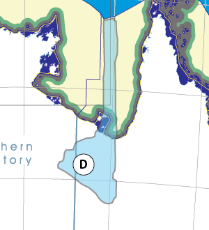
|
Capital: |
Mount Isa 22,785 |
|
Others: |
Georgetown 254 Burketown 173 Jingili people some percentage of ~6,330 |
|
Super region: |
Gulf of Carpentaria B,C,D,E,F,G Great Artesian Basin https://www.bloggerme.com.au/map-great-artesian-basin |
| Hospital: | Mt Isa Base Hospital |
| University: | NO |
|
Airport: |
http://www.mountisaairport.com.au/ |
|
Basin Authority:
|
Leichhardt Albert Basin Authority (LABA)
http://www.bom.gov.au/qld/mt_isa/ State Pin http://www.pinterest.com/pin/418553359092409026/
|
Thanks for checking this Region out.
This Region is prepared on the a-political concept that if you are interested in 'place' in Australia, the most important aspect that defines 'place', is the 'flow of water'. The Senate is interested in 'place'.
This Region defines its boundaries at the top of the ridge, where water flows one way rather than the other. This leads to a very interesting 'place'.
We are seeking a debate with people who live in this proposed new Region. We know we've got the Region pretty well correct; after all, it's just geography. But if you live in this Region you can tell us a lot of interesting things.
- Do these boundaries define a place that is unique; different to every other Region in Australia? We think that that is probably quite likely.
- Is it a great place, worthy of recognition?
- Upon formation, what should be the name of this Region? Who would be the Lord Mayor? Who would be the two Senators who represent this Region? Who would be the additional Senator that represents the interests of Aboriginal & Torres Strait Islander peoples in this region? What benefit would flow from a concept of a the super-Region for the whole of the Gulf of Carpentaria?
- Would life be enhanced if it was on a fast Ring-Rail that links the Capital City to every other Capital City in Australia?
- Many other interesting things!
We think that this is a great new concept of regional statehood based on real concepts that define life in this particular Region. What do you think?
Land projected to be below annual flood level in 2050
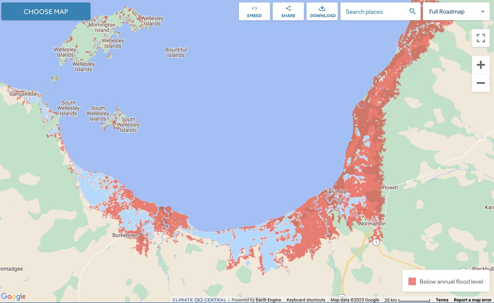
Comparison: long-term sea level outcomes
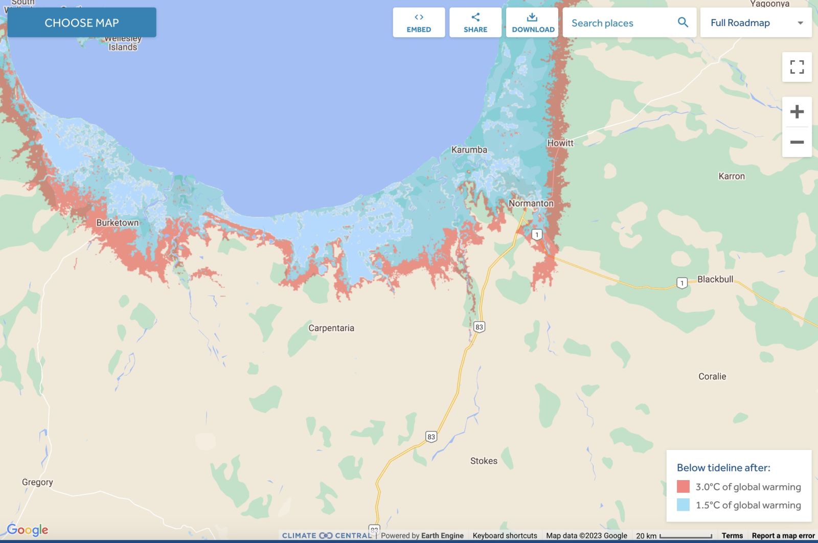
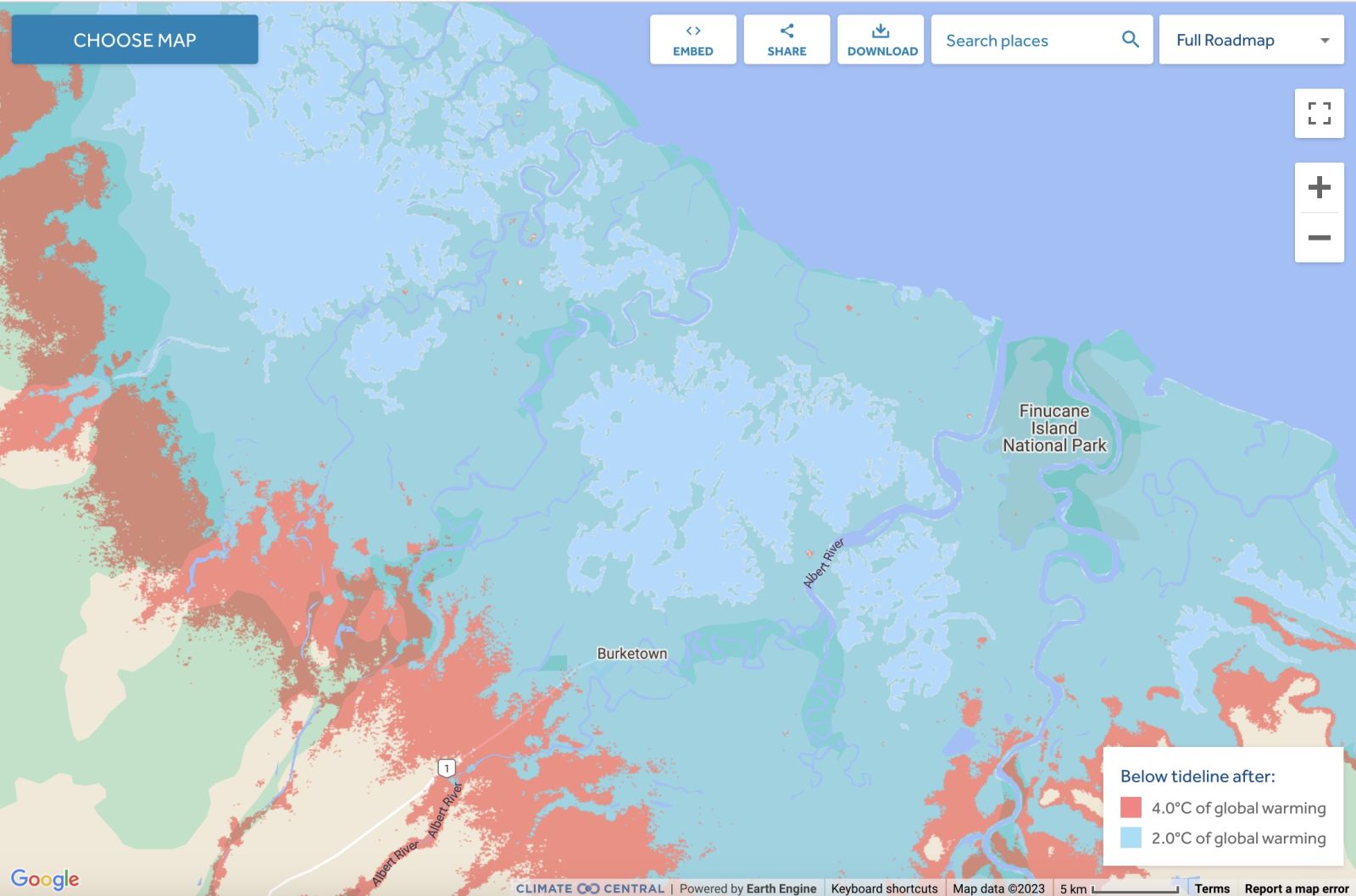
Comparison: long-term sea level outcomes
|
Aboriginal Australia:
|
|
|
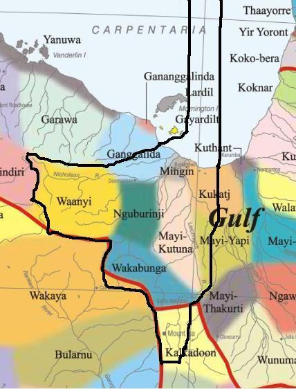
NOTE1: Likely indicators only; for original Aboriginal Australia Map © 1991 & restrictions on its copy & use, see Aboriginal Australia Map NOTE2: The red line is part of the original Aboriginal Australia Map © 1991. The black line is added by Bloggerme for discussion only. It shows the likely State boundary based on the flow of water only. As "the ridge" (See FOWTOR) naturally impacts on the development of the language, social or nation groups of the Indigenous people of Australia, the proposed border is often identical to the group boundary shown on the Aboriginal Australia Map. This is as was expected. Variations are social/historical & result in a particular language, social or nation group being represented in two adjoining States. |
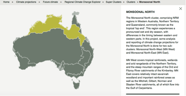 |
Other regional projections - CSIRO part of Monsoon North regionThe CSIRO has regions for projecting the impact of Climate Change. See https://www.climatechangeinaustralia.gov.au/en/climate-projections/futur... This state, Wurung State (D), is one of the clear projections in a CSIRO cluster called "Monsoon North region". CSIRO's Monsoon North region coincides exactly with BloggerMe's K,J,H,G,F,E,D,C,AF. |
Nuclear weapons
Centre ground zero CGZ - Mt Isa - 475 kilotons (431 kilotonnes)
https://nuclearsecrecy.com/nukemap/
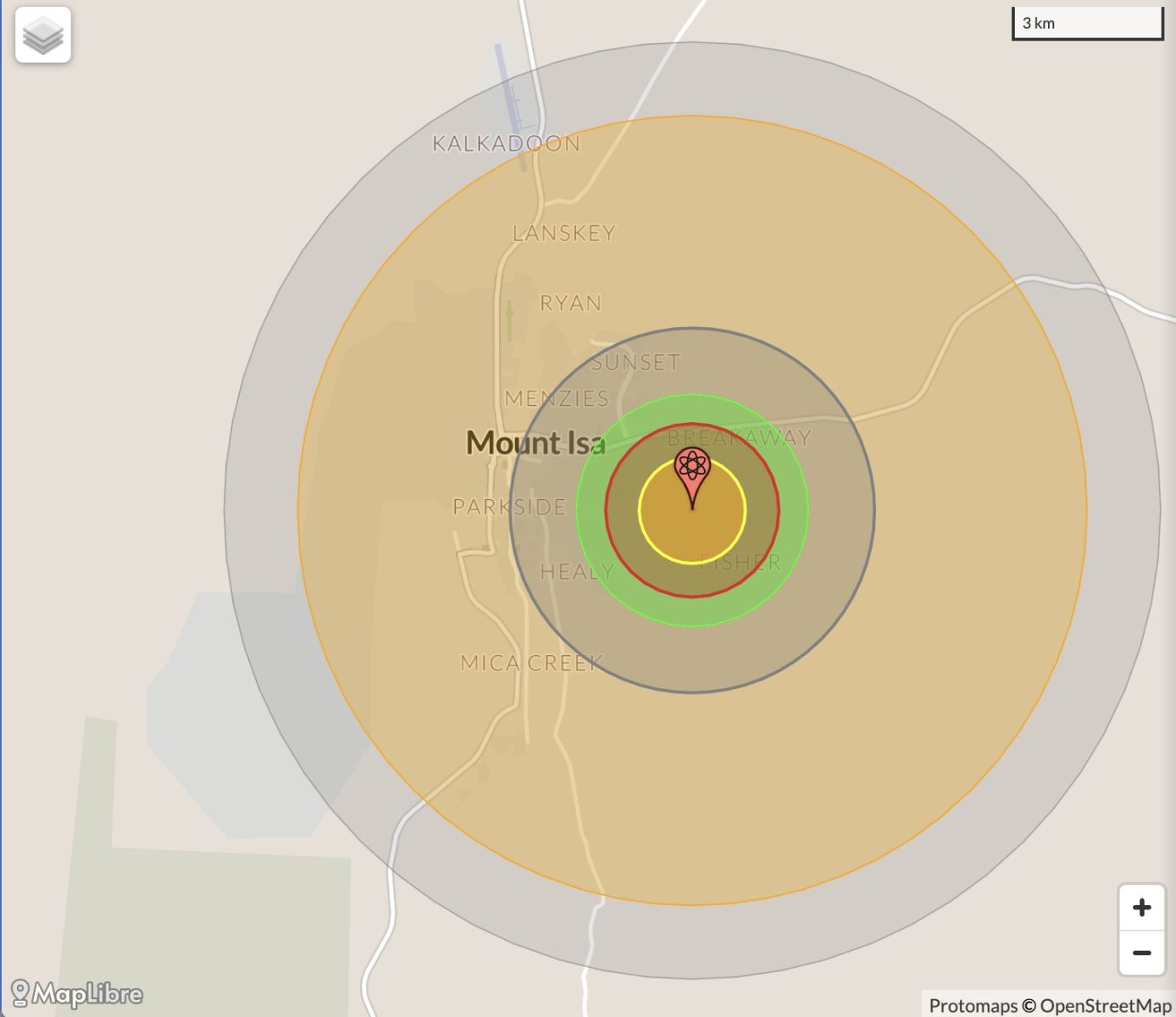
NB: population 10km around Mount Isa CBD LEGEND
https://australia.places-in-the-world.com/11523830-places-within-10km-ar...
Population taken out by nuclear weapon = 17,582
Click here to:

Comments
Steve Irons
Tue, 06/10/2020 - 7:19pm
Permalink
Beauty
West Leichhardt
https://www.pinterest.com/pin/418553359094644533/
Weir on Nicholson River
https://www.pinterest.com/pin/418553359094866932/
Steve Irons
Thu, 13/03/2014 - 12:07am
Permalink
Ex-tropical cyclone Gillian
http://www.bom.gov.au/products/IDQP0012.shtml
Steve Irons
Tue, 04/02/2014 - 11:43pm
Permalink
Tropical Cyclone Fletcher
Twitter
Tue, 26/02/2013 - 4:35pm
Permalink
FIFO & DIDO
FarmOnline @FarmOnline
Cure for rural 'cancer'?: IF fly-in fly-out (FIFO) and drive-in drive-out (DIDO) work-forces are a “cancer of ... http://bit.ly/Ymna31
Twitter
Mon, 25/02/2013 - 4:41pm
Permalink
Gas pipeline
Top End Tweets @TopEndTweets
NT push for gas pipeline link with Queensland: Northern Territory Chief Minister Terry Mills says he w... http://j.mp/WWrVyT
Twitter
Fri, 09/11/2012 - 9:06pm
Permalink
Cape Londonderry to Cape York
CSIRO @CSIROnews
Prawns this Xmas? Our research collaboration - the Northern Prawn Fishery - is now certified as sustainable! http://ow.ly/f97gV
Twitter
Wed, 31/10/2012 - 1:10pm
Permalink
Homelessness in Mt Isa
Homelessness Aus @HomelessnessAus
New report released @AHURI_Research: Indigenous house crowding http://bit.ly/RrKGsy New ABS def found nearly 30% of h'less pop is Indigenous
Twitter
Thu, 25/10/2012 - 7:12pm
Permalink
Kalkadoon people
ILC UNSW @ILC_UNSW
INDEPENDENT financial & legal advice being sought for a formal meeting of Kalkadoon People, Kalkadoon Community Pty Ltd http://www.northweststar.com.au/story/419577/kalkadoon-group-seeks-legal-advice/ …
(Editor: See http://www.qsnts.com.au/index.cfm?contentID=88
Twitter
Wed, 24/10/2012 - 12:46pm
Permalink
Uranium mining changes
Richard Hemming @Richard_hemming
Uranium speculative minnows set to explode http://www.smh.com.au/business/uranium-speculative-minnows-set-to-explode-20121024-284ac.html … via @smh Get your radioactivity in http://www.undertheradarreport.com.au
Add new comment